
Glengarry Forest
Glengarry Forest
Click on each Nature Connection Activity icon to see details and a 360º view of the surroundings.

Starting Point

Nature Connection Activity

Useful Extra Directions
Further Areas of Interest
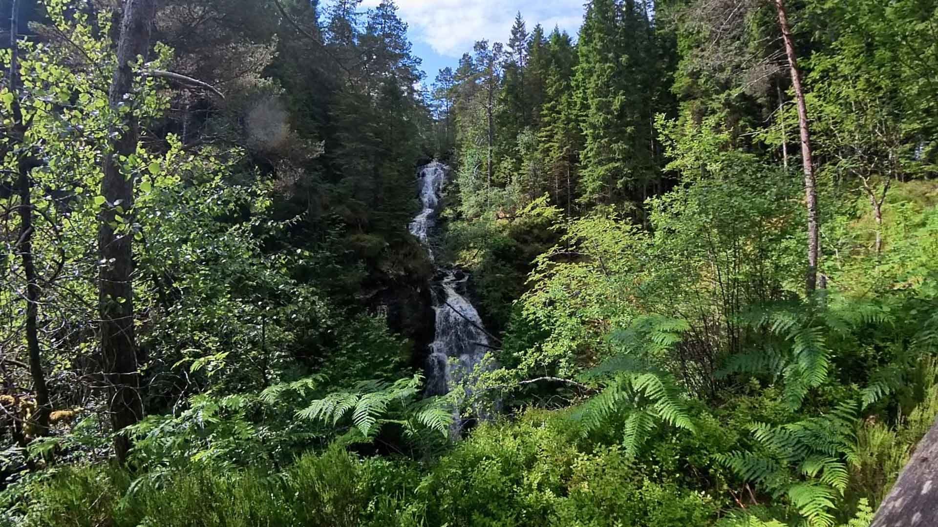
The walk above is just over a mile there and back. The paths are mainly smooth gravel with some slightly uneven sections, and includes a small number of short gentle gradients. There is the option to continue past two waterfalls and complete a loop of approximately 3.4 miles.
Click on each Nature Connection Activity icon to see details and a 360º view of the surroundings.
About Glengarry Forest
Glengarry Forest runs alongside the beautiful River Garry and is predominantly coniferous with an abundance of towering Scots Pine trees mixed in with native deciduous broadleaf trees including Oak, Alder, Birch, Rowan, Hazel and Willow. The paths are bordered by ferns, heathers and bilberry as they weave through trees and an expanse of astounding mosses and lichen.
Getting Here
Glengarry Forest is just less than 2 miles west of Invergarry on the A87 (from the A82 take the road towards Kyle of Lochalsh) and the Forest Car Park is clearly signposted.
The nearest postcode is PH35 4HG.
Forestry and Land Scotland have recently introduced charging for parking in many of their car parks.
The charges to park at this forest car park are:
£1 for up to 1 hour for all vehicles
£3 for all day for a car with up to 7 seats
Blue badge holders park free, but please display your Blue Badge clearly.
This interactive nature connection map was funded with grants from
Think Health Think Nature and The Highlands and Islands Climate Hub.

